Have you ever thought of getting lost in the mountains or in caves, where there are endless routes you can take but you can’t seem to find your way out? There are multiple stories we can hear about this, stories of miracles by following a light. A magical light which they followed and found their way out. On our climb to Mt. Pulag I thought this would happen to me. Well, it did, and I saw lights to find my way back, only literally.
About Mt. Pulag
At 2,926 masl, Mt. Pulag is the highest mountain in Luzon and the second highest in the Philippines. It is one of the most picturesque mountains in the whole country with multiple trails to choose from to get to the summit; Ambangeg Trail (easy trail), Akiki Trail (killer trail), and Tawangan Trail (bloody trail).
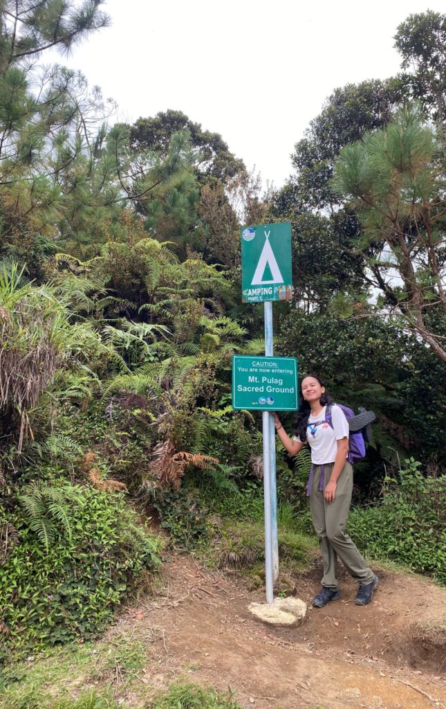
Dubbed as “Playground of the Gods”, Mt. Pulag is known for its sea of clouds, grasslands summit, and the cold temperature. The hike from the ranger station to the summit via Ambangeg Trail would take 2 hours for hardcore hikers and up to 10 hours (according to our guide) for beginners.
Pre-Hike Journal
Baguio City
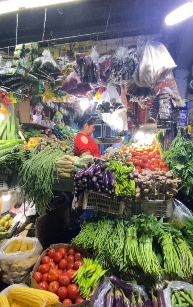
The night before going to Kabayan, my friends and I had dinner at the Good Taste restaurant and bought our camp food at the public market. We based our meal plan on what we could find at night in the public market. For our camp food, we bought rice, salted eggs, tomatoes, onions, string beans, and a sinigang mix.
At 10:00 the next day, we arrived at Dangwa Terminal and looked for public transportation going to Bokod or Kabayan, Benguet. Jeepneys and buses bound for Bokod or Kabayan either leave at 1:00 pm or 2:00 pm so we decided to board the van going to Bokod, which only leaves when it gets full. The one-way fare was Php 250 and we were the first passengers.
After 30 minutes of waiting for more passengers, we were forced by time to ask the driver how much it costs to hire a private van transfer from the terminal to Kabayan, so we could leave the terminal already. We were worried it would take hours to get all the seats full that we could not hike to Camp 2 on the same day. So we hired the van for Php 6,000, left the terminal at 11:30, and dropped by Mt. Pulag – DENR for orientation at 13:00.
Mt. Pulag – DENR
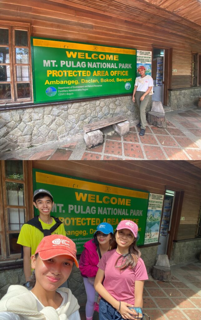
After a 30-minute orientation, we paid for the camping and entrance fees. They sell souvenir items like caps, shirts, gloves, etc. and we bought matching caps and also gloves.
After buying food in the nearby carinderia that sold rice for Php 20.00, we left for the ranger station at 14:20.
Babalak Ranger Station
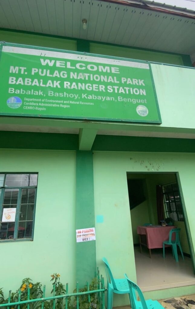
We reached Babalak Ranger Station at 14:40 and paid the fees for barangay maintenance, environmental and cultural heritage, and a guide/porter.
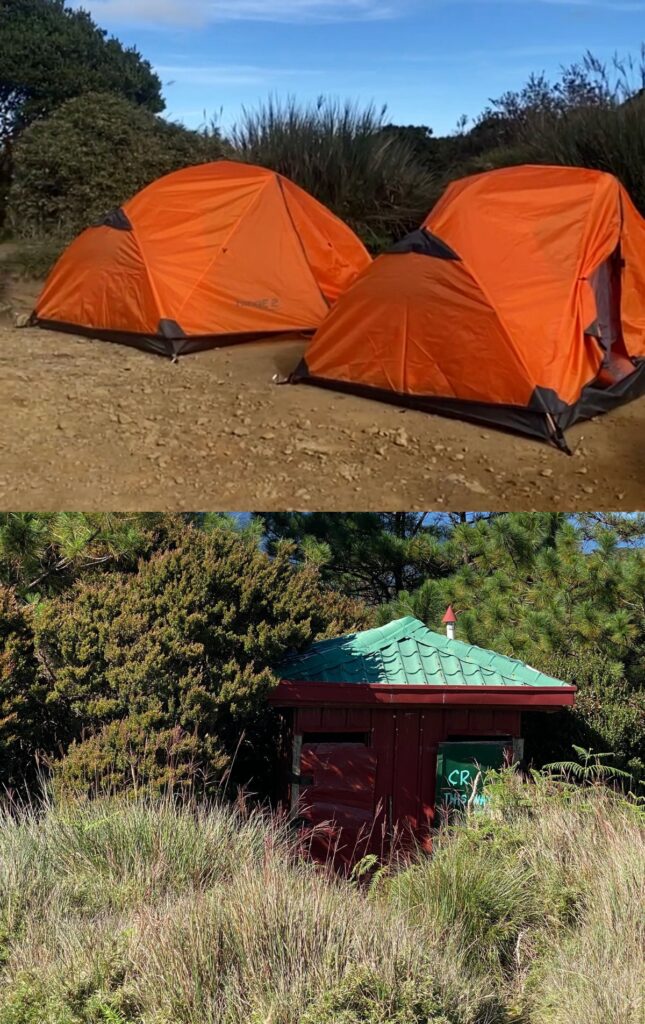
We also rented two 2-person tents for Php 900 and fixed our things for the porter before starting the hike to Camp 2.
Hike Journal
Babadak Ranger Station
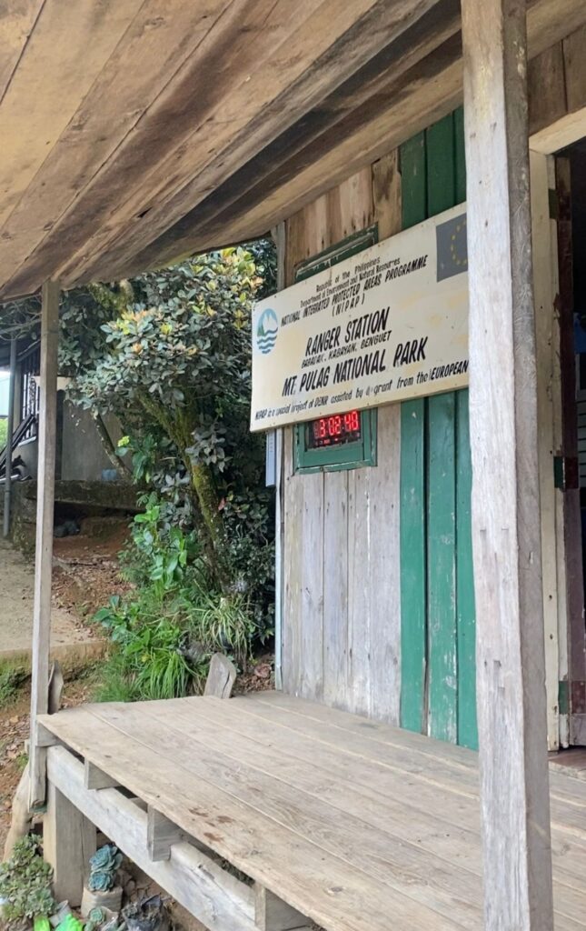
Ten meters from the Babalak Ranger Station is the Babadak Ranger Station. I initially thought it is the same building, only old and new but when I studied their signages, the new building is spelled as Babalak and the old one as Babadak. I am still curious about the difference between them, or if Babalak and Babadak are the same and Babalak is supposed to be the new building for the ranger station. But there are different fees paid at both buildings and the new building looks more like a barangay hall.
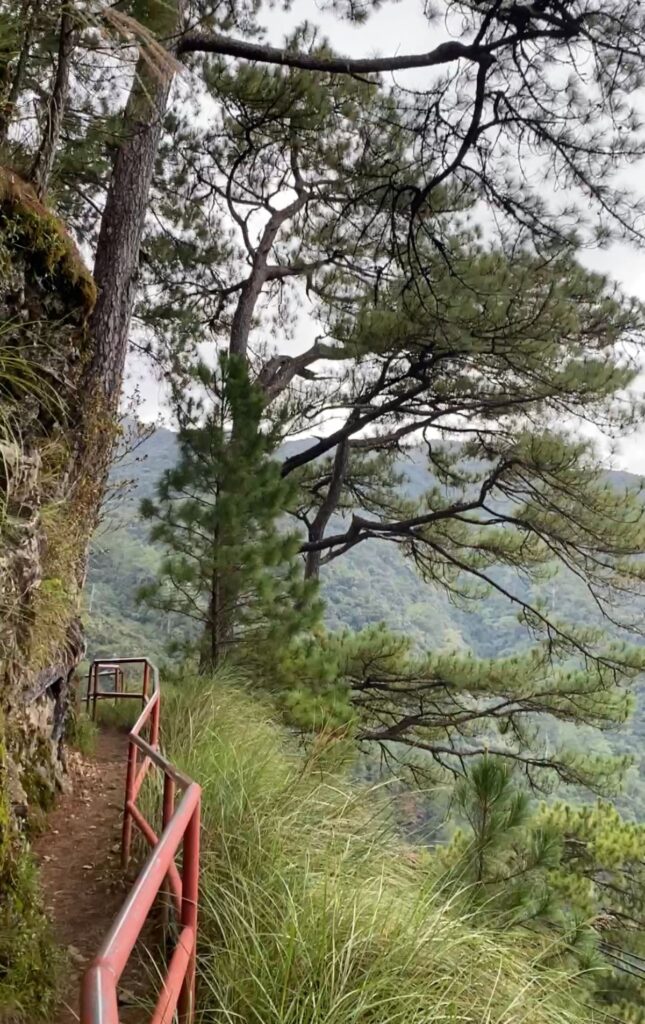
So anyway, we started hiking from the Babadak Ranger Station at 15:40. The trail at the beginning was full of pine trees, similar to the Echo Valley in Sagada. For the first 10 minutes of hiking, the trail is still accessible by motorcycle. We also passed by teenagers who lived in the area, who seemed like they were going home from an outing.
It took us 45 minutes of hiking to get to Camp 1. The hike was relatively smooth and easy. There were barely any uphills until the uphill near Camp 1.
Camp 1
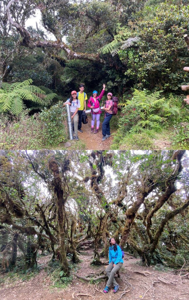
We reached Camp 1 at 16:25, took photos, rested for 10 minutes, and left for Camp 2. It was a transition from a mossy forest to a bonsai forest on the trail, which looked really nice. The trail is very well-established; it is impossible to get lost even without a guide. It is also an easy hike. The terrain is beginner-friendly.
Camp 2
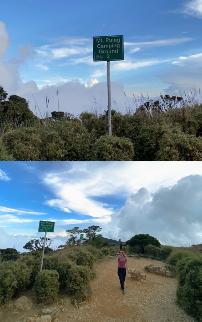
At 17:30, Marielle and I arrived at Camp 2 earlier than the group so we could set up camp while the sun was still out. But we were mesmerized by the grasslands just above the campsite so we took photos instead. When we were done taking photos, Kuya Ryan, our guide, already set up our tents for us. Thank you, Kuya Ryan!
Camps 1 and 2 have comfort rooms, but I feel it’s better to bring a trowel and do your business properly in the forest if allowed.
The hardest thing for us wasn’t actually hiking but cooking dinner because we only had charcoal for cooking. We had a butane stove prepared but we couldn’t find a screw-type butane gas for it when we went to the public market, so we decided last-minute to use only charcoal for cooking at camp.
At the orientation, it was mentioned that a campfire is not allowed at Mt. Pulag, so we asked at the Ranger Station if using charcoal for cooking is allowed, and they said yes.
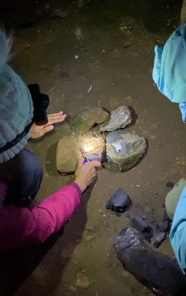
Kuya Ryan suggested we cook by the guides’ shelter and when they heard we could not start a fire from charcoal, they offered the butane stove they were using upstairs. We used the butane stove for cooking rice and while the rice was cooking, we still tried to use the charcoal for frying our smoked fish. It was really hard to start the fire, possibly due to lower oxygen at higher elevations, or the charcoal we bought just wasn’t easy to ignite. But to keep the fire going, we had to continuously fan the charcoal.
At around 20:00 to 21:00, we finally got to eat a well-deserved meal; rice, smoked fish, salted egg salad, string beans stir-fry, and a sinigang mix soup. We cooked everything we planned to eat until the next day. We actually regret having this much food for camping at Camp 2 because it took a lot of time to prepare. We could’ve just had cup noodles or canned goods but since we thought of including the guide in our camp meals, we opted for well-cooked food. Turns out, guides eat early and bring their own food so they were already sleeping when we tried to call them for dinner.
The Hike Before Dawn
We started hiking at quarter to 04:00. There wasn’t much to see hiking before sunrise because it was really dark. Although it was memorable when I almost got lost when I deviated from the usual route in the grasslands.
It started when I asked permission from Kuya Ryan if I can be ahead so I can sweat and be warm. He said to follow the lights from the other group ahead of us. The group in front of us was kind of fast that they also didn’t need to rest from Camp 2 to the summit. When I caught up and saw their lights turning right, I found a trail straight uphill. I immediately thought it was a shortcut and if you know me well, I definitely take uphill shortcuts without second thoughts. So I went uphill instead of following the other group that turned right going around the hill.
When I reached the top, I tried to wait for the lights that went around the hill to show up, but there was none. The trail also got scattered; it was hard to find the established path in the dark. I still waited for the lights to show up for a few minutes until it became foggy and I couldn’t see the bottom of the hill anymore. It was creepy enough to see the fog at the bottom of the hill, what more if it thickens and covers the whole hill, so I decided to turn back.
It was still really dark and I couldn’t find the route I came from. It was scary for a few minutes not knowing the way until I saw a group of lights from afar, on the trail. I was flashing my light to them from the top of the hill. They knew I was not on the trail so they stayed where they were so I could follow their lights back. It took me 5 minutes to find the trail downhill and was very thankful for that group who didn’t mind waiting for me to find my way back.
When I caught up with Kuya Ryan and the rest of the group, it turned out I was also right. It was a shortcut and Kuya Ryan said he estimates I would reach the summit from Camp 2 in only 40 minutes if I didn’t turn back.
Summit
It was 04:40 when we reached the summit. Sometimes there are two confusing paths you could choose from while navigating the trail, but they will meet on the other end. Kuya Ryan mentioned there was only one path where you could easily get lost in. It was the path to Akiki Trail near the summit and Kuya Ryan said it would be hard to find you if you get lost in there.
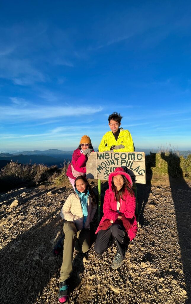
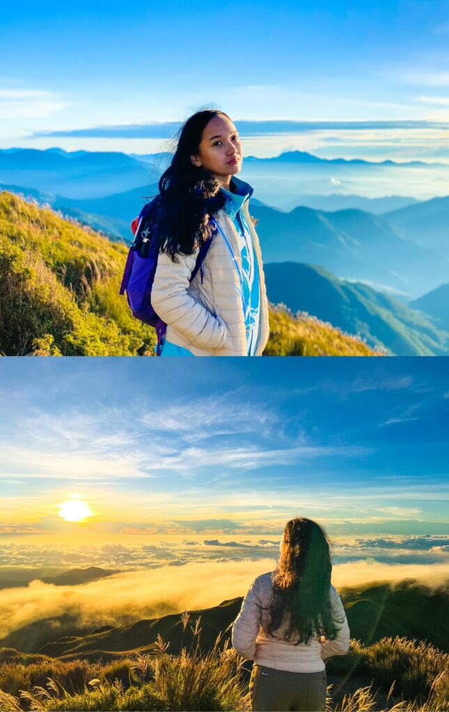
The sunrise was amazing and the sea of clouds also showed up. We were incredibly lucky for our first time hiking at Mt. Pulag. We spent hours at the summit, taking photos and admiring the sunrise, sea of clouds, and layers of the Cordillera mountains. It was Tuesday and there were several people who shared the summit with us and I could only imagine what it would be like if we hiked during the weekend. It would be really crowded.
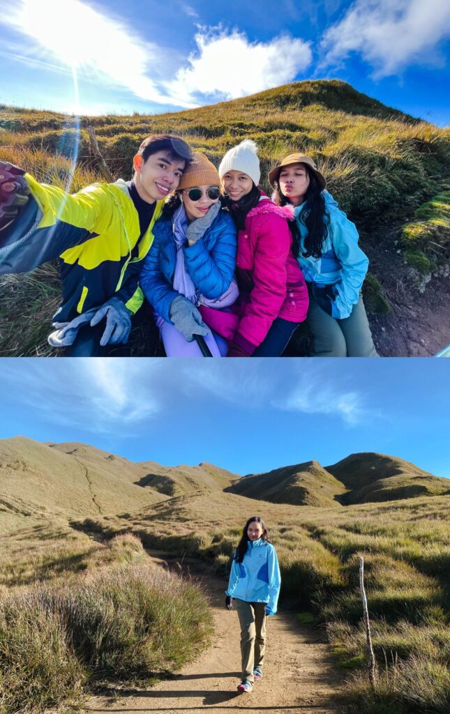
Grasslands
Hiking back, we could finally appreciate the beauty of the grasslands surrounding us. Every part of the Ambangeg Trail is a feast for the eyes, from the pine trees, mossy forest, bonsai trees, to the grasslands. I finally understand why even non-mountaineers would want to hike Mt. Pulag.
Kuya Ryan also had a trivia for us on our hike back. Did you know Ambangeg, the name of the easiest trail to the summit of Mt. Pulag, means lots of ghosts, or in Kuya Ryan’s words “madaming mumu”? It was definitely something to ponder while hiking, was it because of the mossy forest or the vast grasslands? Good thing I didn’t know about this when I almost got lost on the shortcut earlier. The fog and the darkness were creepy enough, it would be the worst to add a ghost in the fog in my imagination.
At 07:20, we made it back to Camp 2. We ate breakfast, rested and/or slept for an hour, and headed back at 09:00 for the van at the jump-off point we were supposed to meet at 12:00. We took our time hiking back, taking lots of pictures in the mossy forest and resting at Camp 1 for almost an hour.
Post-Hike Journal
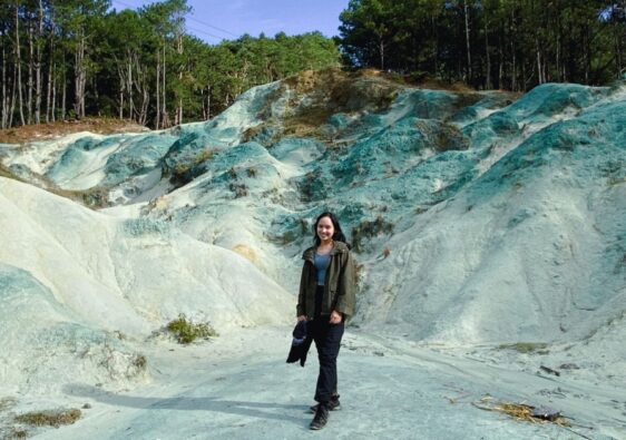
We reached the van by 12:00 and made a side trip to Badekbek Sulfur Spring at Daclan, Bokod, Benguet, before heading back to Baguio City.
All you need to know
Water Source
As per orientation, there are water sources along the trail, from Camp 1 to Camp 2, but potability is not ensured.
Requirement
Medical Certificate
Transportation
From Baguio City, you can hire a van or ride public transportation to Kabayan, Benguet. We happened to bargain a semi-private van transfer for Php 6,000 for a round trip cost from Dangwa Terminal to Kabayan, Benguet. Other people have also recommended hiring a monster jeep but it is more expensive at Php 9,000 round trip.
For public transportation, you can either go to Dangwa Terminal or Slaughter House and here are the one-way fares:
At Dangwa Terminal
Van to Bokod: Php 250 (Only leaves until full)
Jeep to Kabayan: Php 100 (Leaves at 1:00 pm)
At Slaughter House
Bus to Kabayan and Vice Versa: Php 100 (Leaves every 9:00 am and 2:00 pm)
The tricky part about riding public transportation is that you have to get off at Mt. Pulag DENR for orientation, and it is roughly 20 more kilometers to get to the Ranger Station. What I would do if I took public transportation to DENR is to hitch a ride to the ranger station from other groups you meet at the orientation. Our van driver had also mentioned you can ride a habal-habal from DENR to the ranger station for Php 500.
Hiking Fees
Mount Pulag National Park DENR
Bokod, Benguet
Entrance Fee: 175
Camping Fee: 50
Babadak/ Babalak Ranger Station
Kabayan, Benguet
Barangay Maintenance Fee: 30
Environment & Cultural Heritage Fee: 150
Guide Fee: 1,200
Extras
Porter Fee: 1,000
Tent Rental: 450 x 2
Sample Expenses
| Description | Actual Expenses for 4 | For 1 | Solo Day Hike Basic Expenses |
| Roundtrip Transportation | 6,000 (Semi-Private Van Transfer) | 1,500 | 200 (Public Transportation) |
| Entrance Fee | 700 | 175 | 175 |
| Camping Fee | 200 | 50 | N/A |
| Barangay Maintenance Fee | 120 | 30 | 30 |
| Environment & Cultural Heritage Fee | 600 | 150 | 150 |
| Guide Fee | 1,200 | 300 | 1,200 |
| Porter Fee | 1,000 | 250 | N/A |
| Tent Rental | 900 | 225 | N/A |
| Total | 10,720 | 2,675 | 1,755 |
Tips
- It’s best to spend the sunset at the summit and sunrise at the tower site near Camp 2. The sea of clouds will be nearer from the tower.
- Ber months are the coldest months for hiking, and proper layering of clothes is needed.
- If you’re buying food, butane gas, and other hiking stuff last-minute, Dangwa Terminal is just in front of the public market so it’s very convenient.
- Mt. Pulag – DENR and Ranger Station is open for hikers all week long.
- If you’re going to spend overnight at Camp 2, the cut-off for hiking is 5 pm.
- You can prepare everything at the last minute if you’re hiking during weekdays, but you have to secure your slot at DENR and book a homestay (if opted) if you hike during the weekends.
Happy hiking!