Story Time
Coming from Palawan, Mt. Mantalingahan has been on my bucket list since 2022, when I conquered my very first mountain, Mt. Victoria.
Before we climbed Mt. Victoria, we only knew one group of people in our town who climbed mountains occasionally. They were Ate Big, Kuya Dave, and Ate Nina from Credit Union. When Marielle’s (my fellow adventure junkie friend) mom mentioned to them that we wanted to try mountaineering, we got an invite to climb Mt. Victoria from Ate Big. A year later, Marielle and I were invited, once again, this time, to summit Mt. Mantalingahan.
The funny thing is, I only knew Mt. Mantalingahan was the highest mountain in Palawan and that was it. When I climbed Mt. Apo in April 2023, I was surprised that some of the mountaineers I met asked about Mt. Mantalingahan, when they knew I come from Palawan. Turns out, Mantalingahan is on the top 3 toughest mountains to climb in MIMAROPA, if not the whole country. A hard core Filipino mountaineer would definitely have Mantalingahan in their bucket list mountains.
I also only knew that it had a 9/9 trail difficulty when a fellow hiker said to me “Sana all, practice climb lang ang Mt. Apo.” and goes on to say that Mt. Mantalingahan has a 9/9 trail difficulty. At that moment, I was psyched to know I will be climbing one of the toughest mountains in the Philippines and got more excited that it is not just a mountain in Palawan.
About Mt. Mantalingahan
The highest mountain in Palawan and one of the toughest mountains to climb in the Philippines, Mantalingahan stands at 2,048 masl. DENR Quezon requires a minimum of 4 days of hiking to traverse from the municipality of Rizal to Bataraza.
Trail Difficulty: 9/9
Trail Class: 3/5
Pre-Hike
Day 0 | Permits, Logbooks, and Orientation
There are four official stops that you need to make before climbing Mt. Mantalingahan— at (1) DENR Quezon, (2) Rizal Tourism Office, (3) Rizal Police Station, and (4) Barangay Hall of Ransang, Rizal. Writing your name on a logbook is required at all stops.
Orientation, inspection, and a final check of documents are held at DENR Quezon. A permit is paid for and given at Rizal’s Tourism Office. As the south of Palawan is also known for the insurgency, a quick stop for orientation is held at Rizal’s Police Station. Finally, the permit that is paid at the tourism office is shown at the Barangay Hall in Ransang, Rizal. An additional fee for the Barangay is also paid. At 14:00, when all the logging in of names in the record books was done, we headed to Balen Balen, Rizal, the jump-off point of the climb.
A year ago when the road was not yet established, people hiked approximately 3 km from the highway to Balen Balen. The people who have already climbed Mantalingahan before would say, “Tunaw ka talaga sa unang araw pa lang.” because of the intense heat of the hike to Balen Balen. Today, however, with an established road, hikers can drop off directly at Balen Balen.
Marielle and I were so excited to finally hike when we reached Balen Balen. It was still early in the afternoon and the weather was nice. But exciting as it was, we found out that we were going to set up camp exactly where we were dropped off. So our high spirits also dropped.
It was sad to notice trash at first glance at the basketball court where we dropped off, to the sheltered campsite. As we had a lot of time, Marielle and I picked up trash for a few minutes. There were packets of small junk food and lots of Sting energy drink bottles, but the strangest thing we picked up was a pair of shorts.
At 20:00, we had grilled chicken and nilagang baka for dinner. There was a shelter so we decided not to pitch a tent and use only our sleeping bags for the night. As we slept, it turned out there were lots of mosquitos and it was also extremely hot. Just choose whether to get stung all night by mosquitos or be tucked like food in an oven inside the sleeping bag. There is no in-between because if you choose not to zip your sleeping bag fully to let air in, you’d get the best of both worlds and get stung by mosquitos inside your sleeping bag.
We barely had any sleep, so in the morning, I decided if anyone ever asks me for tips on climbing Mt. Mantalingahan, I would tell them it’s okay not to pitch your tent camping in Balen Balen, thanks to the shelter. I would emphasize just sleeping out so they would experience all the difficulties we had sleeping. It’s part of the Mantalingahan experience.
But on a serious note and as a tip, pitch your tent even though there is a shelter, and save yourself from the annoying mosquitos buzzing throughout the night.
Hike
Day 1 | Balen Balen to Balwing
It was 6:06 when we started hiking and if you already need to refill your hydration bladders, there is a water source just 5 minutes into the hike.
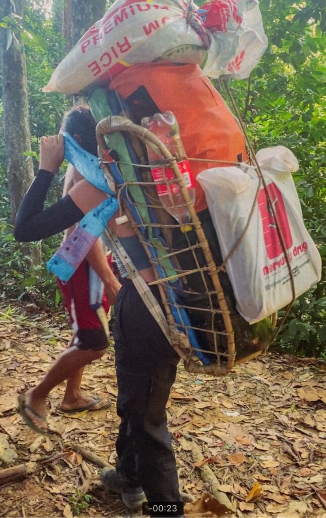
Our guides, Kuya Dinoy, Kuya Jeffrey, and Kuya Ranel were looking for a rarong or backpack they can borrow from the people they know along the way. So at this time, Kuya Dinoy was carrying his load like grocery bags.
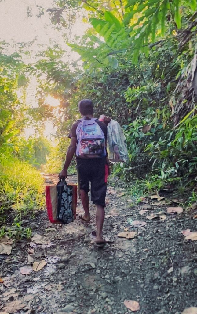
The hike was initially easy, there were barely any uphills until you reach the second stream into the forest, where the calvary starts.
7:07 Manguis Tree
The first rest stop was at a big tree called Manguis. My face was sweating intensely when we reached the Manguis Tree but Kuya Bong told me, it was only just the beginning.
We rested for a while so I had time to try on Kuya Bong’s rarong.
After resting and regrouping we continued our hike before 8. At one point, you would be able to pass by a signage that directs you to the Tao’t Bato Village before reaching another rest stop.
8:42 MMPL Viewdeck
We made a quick regroup and rested in between, so our third rest stop was at MMPL Viewdeck, then we continued hiking before 9.
9:20 Bulldog
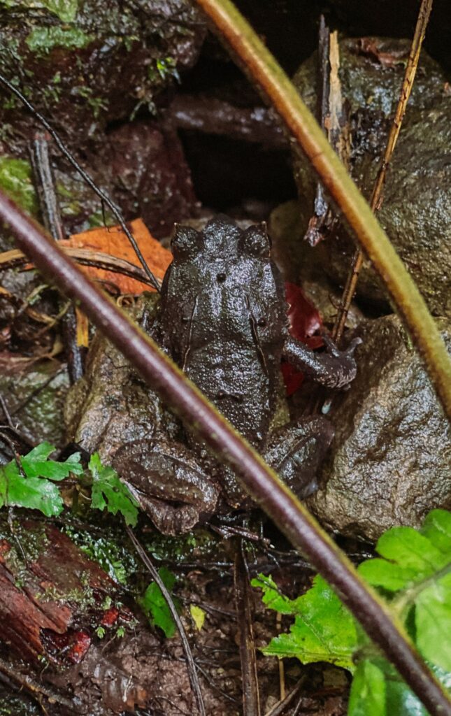
In Bulldog, lots of snacks came out while stories were told. One of them was how a baby is buried nearby and all I can think about was a changeling. Mantalingahan, really is that mountain that will make you think of local and foreign folklore.
They were also talking about early forms of quarantine and isolation in the mountain tribal villages. When a person is sick, he will be separated from the community. The food will be given with no contact, given in between the path from the village to the isolated person.
11:38 Maugat
At 10:10 we continued our hike up. We regrouped and rested after 20 minutes and continued hiking at 11:10. We reached Maugat E-Camp at 11:38 and had our lunch.
It was 13:00 when we started hiking again after lunch. Just 10 minutes into the hike, I had a severe headache. I thought I might have malaria but Kuya Bong asked a few questions and his diagnosis was lack of sleep. Lol. So at 13:50, I was happy that we rested for 40 minutes while waiting for the others.
14:30
It rained when we continued hiking and the rain made the trail harder to hike. Six minutes into the hike, I slipped sideways, while crossing a rocky stream. By then, my brain is convinced all rocks are slippery and I have a 100% chance of slipping. I was hiking slowly and was not able to keep up with the lead pack anymore.
When the trail is wet and muddy it’s best to be in the lead pack because they’re the ones who’ll have a fresh trail. By the time the sweeper pack passes by, the trail would be 5x more slippery than before and it would be harder to find a spot to safely step a foot in when downhill.
Before reaching the campsite, there was a wide farm with a very steep downhill— you can slide on it. I definitely did.
15:15 Balwing
With my pants full of mud, I reached the campsite at 15:15.
We took a bath in a nearby stream and had tinola for dinner at 19:10.
It was nice to finally sleep well without mosquitoes.
Day 2 | Balwing to Paray Paray
8:40 Balwing
It was this day when Kuya Bong was worried if we’ll be able to reach Paray Paray high camp from Balwing, given our pace. We started hiking from Balwing at 8:40 so he was glad that we- Kuya Ranel, Kuya Bong, and I reached Cabogan at 9:55.
9:55 Cabogan
Before reaching Cabogan, I asked Kuya Bong if we would have our lunch there. He said it was still too early to have lunch, but as it turned out, regrouping took more than an hour so by 11, we had our lunch at Cabogan.
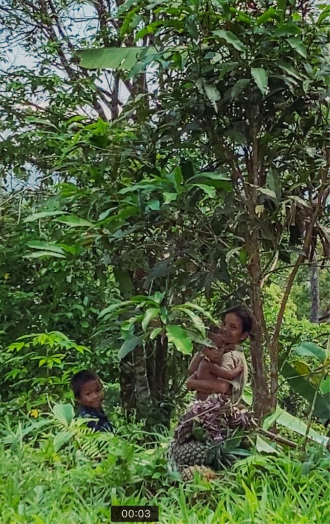
Cabogan is a village occupied by a Palaw’an Tribe. When we arrived, there was a woman who offered to sell pineapples and a small bag made from leaves. Their language is Palaw’an and most of them are not able to understand and speak Tagalog. So when I heard her speak, I was amazed to hear that the accent sounds more like Vietnamese than Filipino.
It was getting a little bit serious before we left Cabogan because we were behind schedule and we cannot afford not to camp in Paray Paray that night. So the group had an agreement that we would no longer regroup and have multiple stops for rest until we reach the high camp. The sweeper pack borrowed headlamps for their guides Kuya Dinoy and Kuya Efren, in case they hike until dark.
13:40 Abong Abongan
We left Cabogan at 12:20, and it rained heavily before reaching Abong Abongan at 13:40. There were also people who live in Abong-Abongan and two children were there when we came. They sold bananas for Php 400, which is ridiculously expensive. Their final offer was at 200 but still, no one bought bananas.
I thought we would only rest for a few minutes at Abong Abongan but we left at 15:00.
15:50 Rest Stop before High Camp
I also thought we would no longer rest after Abong Abongan but when we reached another rest stop after 50 minutes, we stopped and regrouped with the middle pack.
On this day, I knew we were behind schedule so when Kuya Ranel asked me if we should rest and wait for the others upon reaching an E-Camp, I would say “Tuloy na lang”. But for the first time, Kuya Ranel did not ask me if we should rest but initiated that we should rest at the last rest stop before high camp. In his words, “Pahuway muna, may kalaban pa tayo ‘dyan.”. And when he says “may kalaban pa tayo ‘dyan” it means endless uphills and/or difficult terrain. Your enemy is exhaustion.
The hike was tiring. It’s what you would expect from a 9/9 trail difficulty— exhausting and full of uphills and as the day goes on, it just gets more difficult.
I was hiking second to Kuya Ranel, the lead guide and Kuya Bong followed. As I was followed by Kuya Bong, he would always notice how tired I am while hiking and I think we could not relate more to each other. In the beginning, we were only using one hand to hold onto a tree to pull ourselves up. But later, we were using both our hands to hold two trees to pull ourselves up. That’s how exhausted we were from the hike, and imagine what it’s like for Kuya Bong when the load on his back is probably at 30kg.
We left the rest stop to head for Paray Paray at 16:50 but it was not as exhausting as the previous hike from Abong Abongan. We were passing through big rocks and slowly carrying ourselves from one big rock to another big rock, but we preferred it more than hiking uphill. But after the rocky terrain, there we go again— ascents.
18:10 Paray Paray High Camp
We reached high camp at 18:10 and I couldn’t be more hungry, but also happy that I even told Kuya Ranel, it was the happiest day of my life when we reached high camp. But no— it was not the happiest day of my life, that was just the adrenaline and exhaustion. You see, Kuya Ranel as the lead guide, would not try to keep up with your pace but would make you catch up to his pace. After trying to catch up with him for 2 days as a normal person, you would see exhaustion would also catch up to you.
When Kuya Bong arrived we were all looking for food for a quick snack, because the hike and the pace of Kuya Ranel would make you hungry. It was funny that the three of us were looking at the pot of rice when Kuya Bong was opening it, only to find out it was empty.
They fetched water for cooking dinner and I was left alone at the campsite. High camp was cold but I didn’t change into dry clothes immediately because I was waiting for Marielle and the rest of the group. If someone were to take a bath at the water source, then I would too. But when it became too cold wearing wet clothes, I decided not to take a bath anymore and just changed into my camp clothes.
When it got dark, Kuya Jeff arrived. He was leading the middle pack but they were nowhere to be found when he arrived. Turns out, he left them in the trail and Marielle had something to say about this before we slept in our tent that night.
At 8:40, we had chicken curry for dinner.
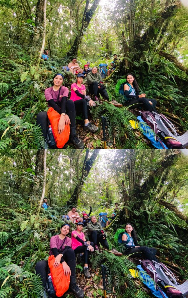
The day was tiring but Marielle and I had time to share things that happened that day. Because during this day and the rest of the days, we weren’t hiking together. I was either in the lead pack or sweeper pack, while Marielle consistently hiked in the middle.
During this day, the dynamic was;
LEAD PACK: Kuya Ranel (Manta Guide), Me, Kuya Bong (Vicky Guide)
MIDDLE PACK: Kuya Jeffrey (Manta Guide), Ate Che, Kuya Dward, Ate Big, Marielle, and Kuya Bebot (Vicky Guide)
SWEEPER PACK: Kuya Dinoy (Manta Guide), Ate Gen, Kuya Dave, Kuya Efren (Vicky Guide)
I talked about how fast Kuya Ranel was going and how bored he gets that sometimes he purposely climbs big rocks while waiting for us. Marielle ranted about Kuya Jeffrey, how he left them on the trail, and how he was surprisingly annoyed about them asking lots of questions.
The story behind this was— when we met in the Rest Stop before high camp, Kuya Bebot overheard Kuya Jeff talking to Kuya Ranel, in Palaw’an language, about how annoyed he was because the middle pack asks so many questions. They didn’t know Kuya Bebot could understand their conversation. It goes to show how guides from Mantalingahan are not used to accommodating hikers yet. But they still have 2 more days to warm up to us, and hopefully, they would also miss us and all our questions after the hike.
Day 3 Summit
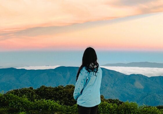
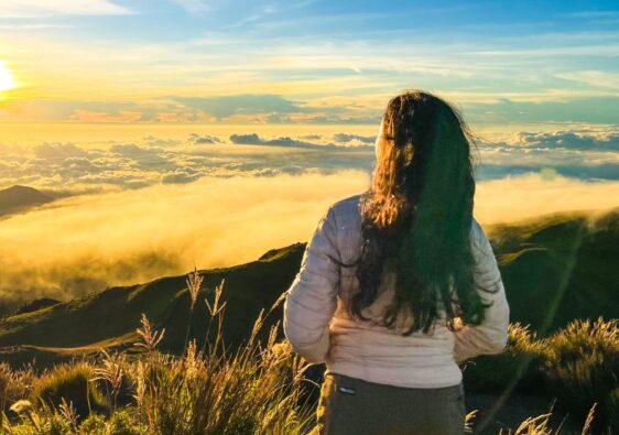
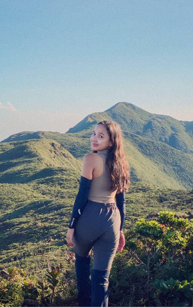
After eating noodles for breakfast, we started hiking at 4:40 and reached the summit at 6:10. We had 2-3 hours to take tons of photos because the sky was clear. Luckily, there was no cloud fog.
At 8:00, we were supposed to hike back to high camp but Marielle and I asked Kuya Bong to stay with us at the summit for 30 more minutes. We wanted to take more photos.
At 8:30, we were preparing to hike back. Kuya Bong purposely hiked with his big dry bag so we asked him if we could put some of our things in his bag. Mine was my hydration bladder and for Marielle, it was her small dry bag.
Funny for us and annoying for Kuya Bong, when he was about to wear the dry bag on his back, Marielle got thirsty and said “Hala, nauuhaw ako.”. You know how you have to put in more work to use big dry bags than normal backpacks— you have to mindfully put your stuff inside for balance, then roll and buckle the top lid, before wearing it on your back. So you see I was laughing about it when I saw Kuya Bong’s poker face when Marielle said she was thirsty.
Kuya Bong was generous enough to put his bag back on the ground again and put out my hydration bladder for us to drink water. But that wasn’t the end of it. After Kuya Bong rolled and buckled the lid of the dry bag, Marielle was looking for her Go Pro, “Hala, asan yung Go Pro ko?”. I laughed hard again because I knew she wanted Kuya Bong to open his bag again.
Kuya Ranel and I hiked to the summit for an hour and thirty minutes so we expected hiking down to be cut to just an hour. But surprisingly, it took more than two hours for us to get back to high camp.
At 10:37 we could already smell from the Bonsai trail the fried chicken they were cooking for lunch at high camp. It made us hike faster to reach the camp back at 10:40.
They were already breaking camp when we arrived while lunch was being cooked. Marielle and I also proceeded to pack our things and fold the tent.
After packing our things and having lunch, we headed to the campsite called Pisa Pisa at 12:35. The hike from Paray Paray to Pisa Pisa takes barely 2 hours. We could probably hike farther to another campsite so we can cut hiking time the next day, but Pisa Pisa was the last campsite that was near a water source so we decided to camp there.
The hike to Pisa Pisa was extreme. After a normal downhill trail, you will be pushing yourself past big rocks, while a cliff is on your right. It’s also difficult to navigate. You would be unsure if you are still going the right way because it looks impassable.
You can pass by the last water source before reaching Pisa Pisa, so at 13:55, I asked Kuya Ranel if we could wait for the others. I was planning to take a bath with Marielle and the others if they were going to.
They arrived 20 minutes later, but no one wanted to take a bath at the time so I wore my shoes and prepared to take off. At 14:55, we left the water source and I envied them for changing their mind and taking a bath. I watched them for 5 minutes thinking if I should join in too but we took off. Instead, I thought about how I would take a bath at the campsite the whole time we were hiking to Pisa Pisa.
15:15 Pisa Pisa
Kuya Ranel, Kuya Bong and I reached Pisa Pisa after 20 minutes. I was able to fill my 2L hydration bladder at the water source so I hung it on a stick I found and used it as a shower, so my problem was solved.
Marielle and I helped to prepare dinner and cooked the macaroni soup. We were really looking forward to this night when we would be able to eat spaghetti and fried chicken, like a Jollibee set meal. But Ate Big allotted the fried chicken for breakfast so we had macaroni soup and spaghetti instead, which I enjoyed so much.
Day 4 | Pisa Pisa to Inogbong
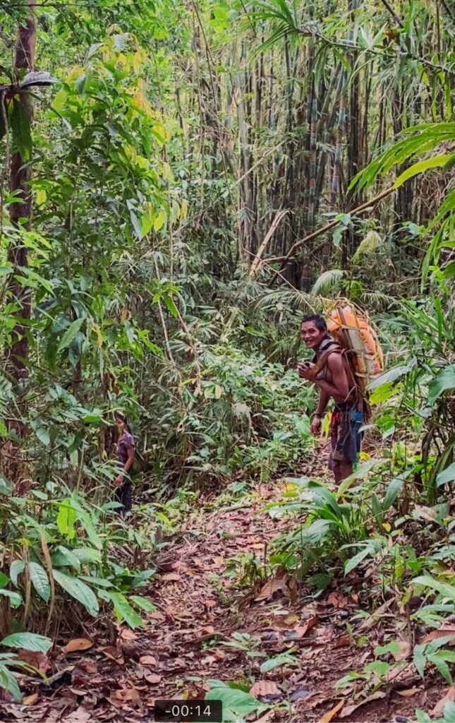
The last day of hiking was pretty chill but extremely long. We started hiking at around 7:15 am and reached civilization at around the same time but in the evening. The dynamic was to hike as one group so I decided to be in the sweeper pack.
It was my first time in the sweeper pack because I always liked to be at the front. At first, I liked to go first when hiking so I could stop for rest, and let other people overtake me without the pressure of catching up because I stopped. By the time I climbed Mt. Apo, people rarely overtook me so I guess being at the lead pack made me happy. I held onto it until our 4th day in Mantalingahan.
I also realized I didn’t get a chance to bond with the others like Marielle did, because I was always hiking with Kuya Ranel and Kuya Bong. I envied the middle pack’s laugh every time they were approaching us near the rest stop. I think it was also time to let my knees rest after 3 days of trying to catch up with Kuya Ranel.
At the beginning of the hike, it was really silent and our pacing was nice. I felt like the group was pressured because almost all our guides were sweepers, except Kuya Ranel. If a fast hiker is at the back and cannot overtake me, I would feel pressured too.
At 8:30, we reached a rest stop in a place with a mossy ground. Since Pisa Pisa, the guides told us to be quiet because a tribal community is nearby. So when we were at the rest stop, we were whispering even if there was no need to whisper. It was funny. The guides were still talking in their normal voice but we took being quiet seriously that we were whispering the whole time.
We also saw 3 natives passing by, carrying birds in a cage and it was so bizarre. My whole life, I’ve only seen Kiyaws in cages (Palawan Hill Mynah) saying words like “panget” or “tao po” and realize this is where they come from. I accepted it as normal before, like they are just pet birds. But seeing it first hand as the were birds illegally taken out of the forest makes me sad. It’s sad that this is a way of life of the natives and both them and almost all Palaweños see nothing wrong about this.
An addition to the bizarre experience was how the natives were walking super fast. They were swift walking, faster than my usual jogging pace. It’s crazy how fast they passed by, it was just a few seconds and we couldn’t hear them anymore.
By around 9:00, we started hiking again and stopped for rest at 10:40 in a mossy forest. We took group photos and had some snacks.
It was around 11:30 when we stopped for lunch. Unfortunately, it rained while we were eating and we had to hike while it was still raining. It’s such a hassle wearing your shoes when your socks are wet so I decided to be brave and just wear slippers all the way.
Between 2 to 3 pm, Kuya Ranel asked if we wanted to take the route to Inogbong instead of Malis (the usual route). They only told us now that there was a shorter route because they were worried about our pacing. In the morning, our pacing was nice and we were still hiking as one group. But after lunch, there were wider gaps in between and we were going slower.
Kuya Bong initiated that we choose the route to Inogbong. This was not his first time in Mantalingahan and he knew the terrain to Malis was technical. It was so much better if there was a shortcut so we took the Inogbong route.
It was evident that we had wide gaps in between when one of us, Kuya Dward, took the route to Malis instead of Inogbong. Kuya Dinoy had to chase him back to the group. It was fortunate that we saw his yellow rain cover while he was going uphill. When we saw him from afar, I thought, this hike is never ending if we’re going uphill again. But when we reached the intersection to either Inogbong or Malis, all of us in the sweeper pack realized Kuya Dward went the wrong way.
It’s also fortunate that he didn’t go too far because he was also having second thoughts about the trail. He said he even passed through a makeshift narrow bridge that’s kind of scary. Kuya Dinoy was able to chase him back in just a few minutes. We were thankful that it didn’t turn out to be a scary experience for Kuya Dward. Just imagine if no one had seen him going uphill. It was just a good laugh, in the end though.
At around 16:00, no one wanted to follow Kuya Ranel anymore. Even Kuya Dinoy and Kuya Jeffrey agree that Kuya Ranel shouldn’t be a lead guide. He’s hiking too fast for the group. We had wide gaps in between so Kuya Dward ended up taking the wrong path. There are better things that can be done to avoid this but if we’re supposed to be hiking as one group, then it’s Kuya Ranel’s fault.
All things aside, I decided to be Kuya Ranel’s disciple again and follow him in the lead. The downhills were going steeper and slippery, and we were going too fast. I slipped a lot of times in just 20 minutes. One time, my butt slapped the ground so hard. It was just me and Kuya Ranel in front and he doesn’t even bother to take a look back or check up on me when I know he hears when I slip onto the ground.
At around 16:40, we reached another rest stop in a small hut. There were tools for pambayo ng palay and pang panday ng itak inside the hut. It was nice to look around. A few minutes later, Kuya Bong arrived after us and there were three of us in the lead all over again.
Hiking with Kuya Ranel leading, expect to have long rest times, and I hated resting at this time. The adrenaline stops when you rest and it’s painful to hike again after resting. At least it was for me, so I decided to be at the sweeper again.
At 17:00 you would really start to count how long you’ve been hiking and how much more you can hike. We started singing and stopped when we greeted some locals we passed by. They (the locals) laughed and told the guides it was evident we were exhausted.
At 19:15 we finally reached the pick-up point where the van would pick us up.
Post Hike
We stopped by the Barangay Hall in Malis, Bataraza to log out and confirm we safely conquered Mantalingahan.
The barangay captain told us the group before us took until 11 pm last time and I was thankful we took Inogbong instead of Malis.
It’s payday for our guides and we also fixed our things from the packs the guides were carrying.
We had dinner at Brookes Pt. at around 21:00 and I already miss the food we ate in the mountains.
Four to five hours later, we were finally back in Aborlan.
All you need to know
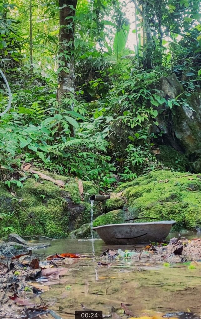
Water Source
There are multiple water sources along the trail. The flowing water from any alulod is safe for drinking.
Requirements
Certificate from previous major hike.
Medical Certificate taken 1 week before the climb.
Transportation
We hired a van to take us from Aborlan to the jump-off point at Ransang, Rizal for Php 6,000.
Going back, we hired a different van to pick us up from the exit point in Bataraza to Aborlan for Php 3,000.
Hiking Fees
DENR Quezon
Conservation Fee: 250 (Local), 500 (Foreign)
Rizal Tourism Office
Registration Fee: 100 (Local), 200 (Foreign)
Ransang Barangay Hall
Environmental Fee: 50
Guide Fee
Porter Rate: 500/day
Guide Rate: 700/day
From MMPL Guidelines, dated Jan. 2023
Sample Expenses for a 5-day hike, with 7 pax
| Mantalingahan | 3,421.43 |
| Hiking Fees | 350.00 |
| DENR Quezon | 250.00 |
| Rizal Tourism Office | 100.00 |
| Ransang Barangay Hall | 50.00 |
| Guide Fees | 500 |
| Daily Rate per group | 700.00 |
| Transportation | 1285.714286 |
| VAN Aborlan to Ransang, Rizal | 6,000.00 |
| VAN Inogbong, Bataraza to Aborlan | 3,000.00 |
| Food | 1285.714286 |
| 5 day meals for 7 pax (plus 3 guides) | 9,000.00 |
Tips and Reminders
- Do not sleep out in Balen Balen.
- Pack light.
- Drink Malaria Prophylaxis 1-2 weeks before the hike.
- There are no river crossings, only small streams.